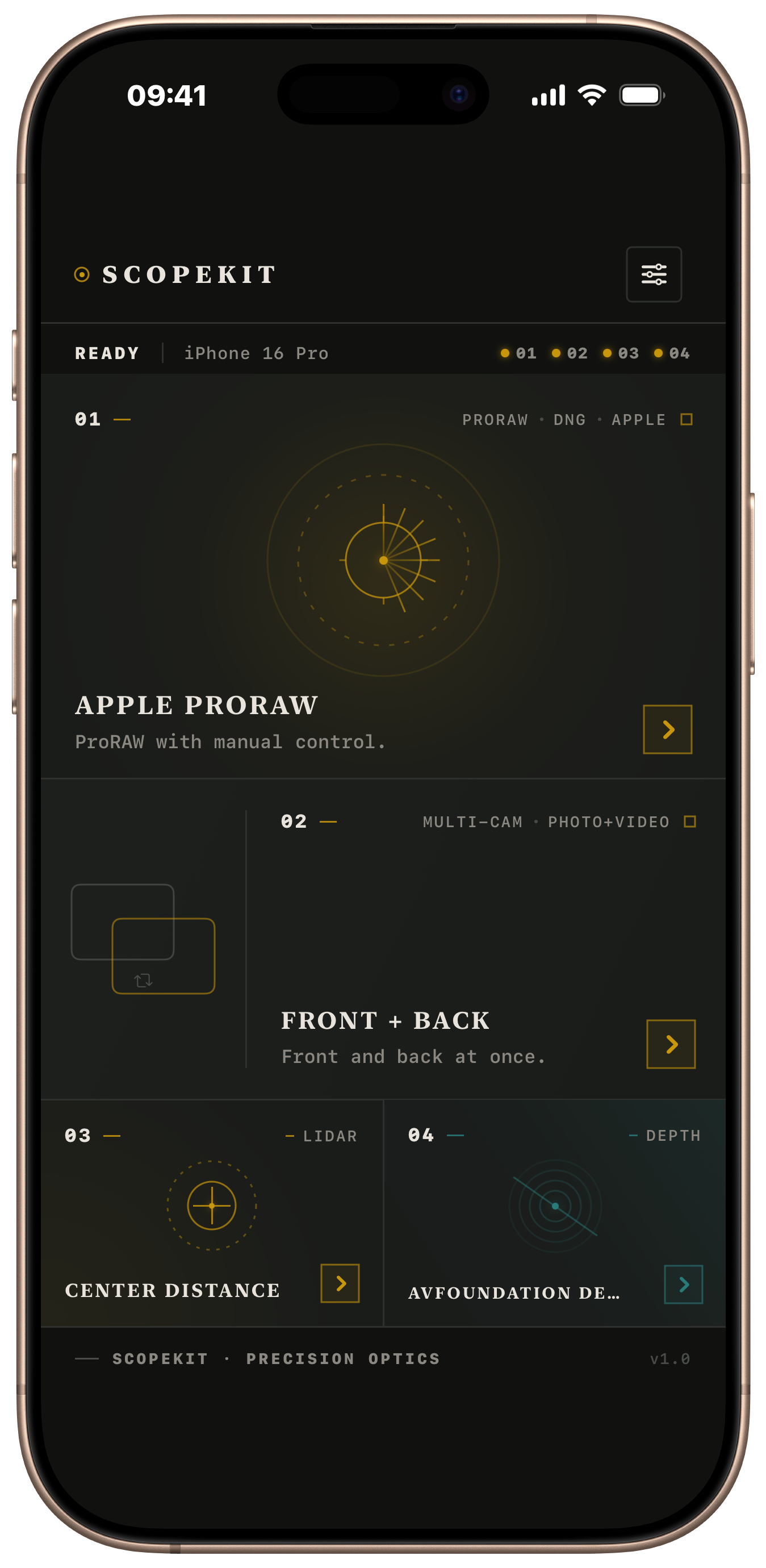
Manual control with a destination that fits real field workflows.
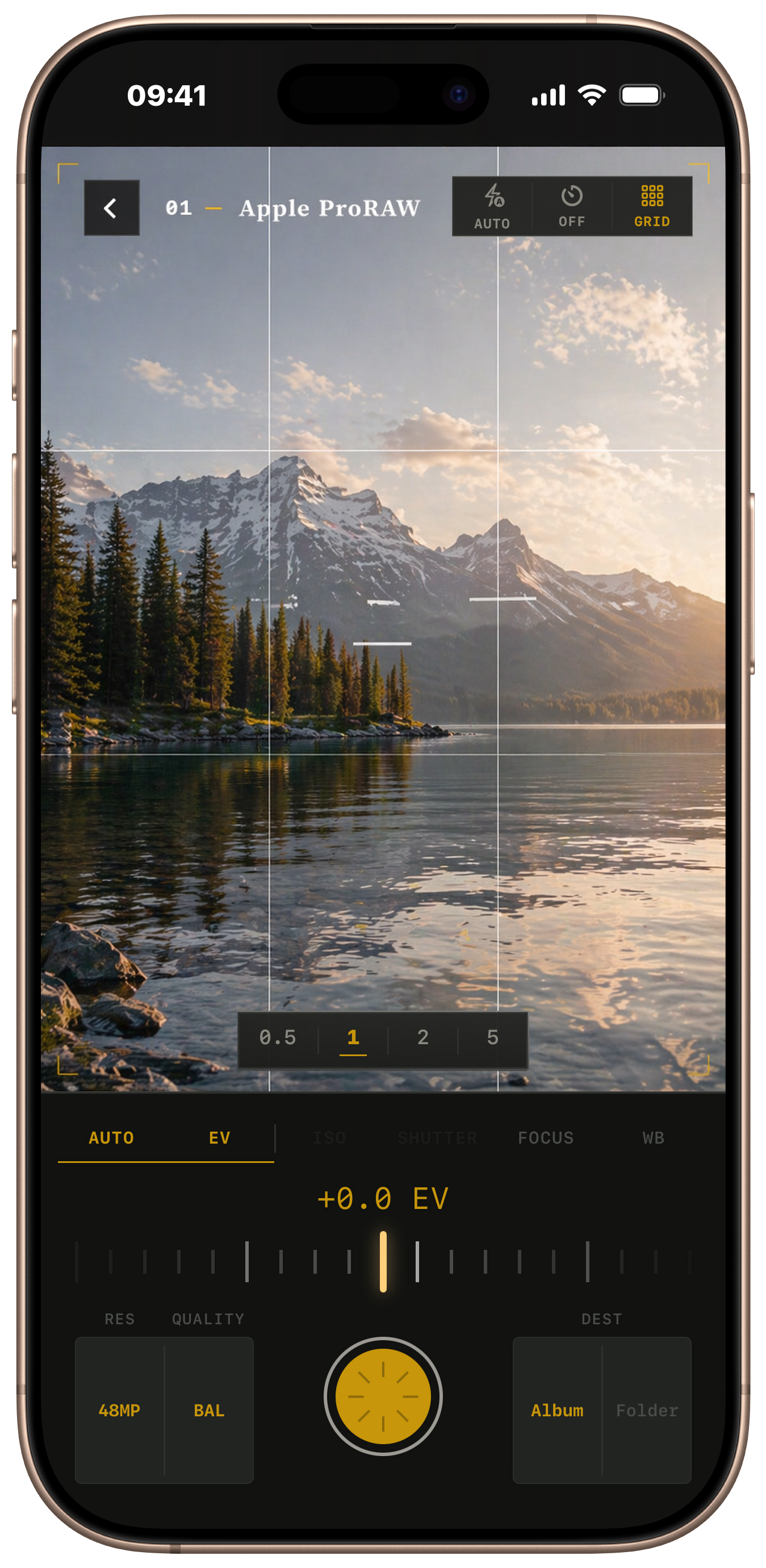
02 · Apple ProRAW
Direct to drive.
Capture ProRAW with manual control over ISO, shutter, focus, and white balance, then send each file where it belongs. The flow stays close to the shot instead of handing the job to cleanup later.
Why it matters
- Destination choices are part of the capture flow, not an afterthought.
- Manual adjustments stay visible and legible while framing.
- The screen still feels calm, even when the controls are precise.
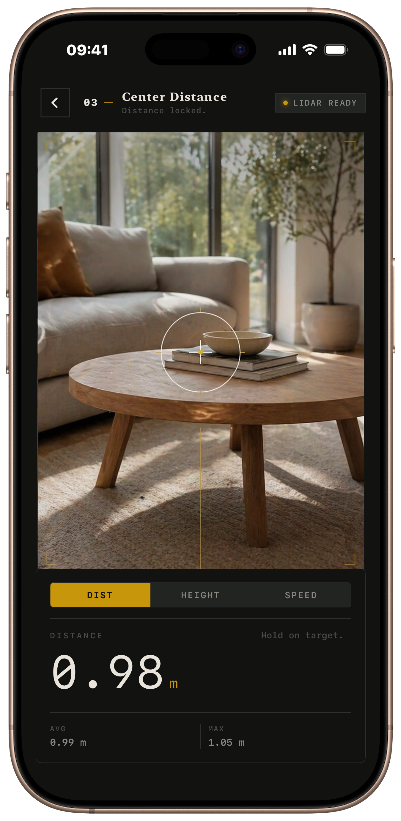
03 · LiDAR Center Sample
Measure three ways.
Distance, height, and speed all revolve around the point you aim at. The readout is immediate, centered, and grounded in the scene instead of floating as a vague overlay.
Proof on screen
- Crosshair, center line, and numeric result all support the same reading.
- The interface shows average and maximum values without crowding the moment.
- Warm measurement accents visually separate sensing from capture.
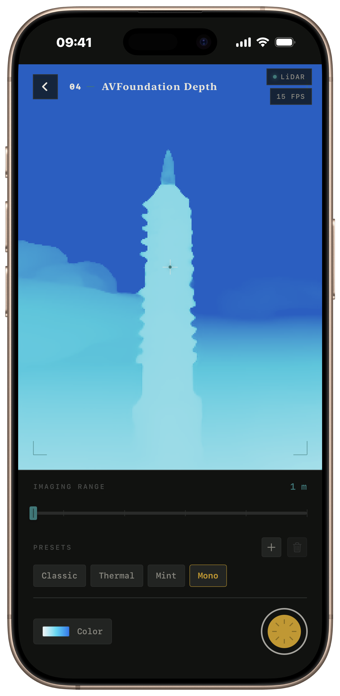
04 · AVFoundation Depth
See depth. Define color.
Depth data becomes a readable live map. Palette controls let the interface move from technical preview to practical visual reference, whether you want clarity, contrast, or a softer field cue.
Color as instrument
- Cyan accents echo the product language without turning the page into a theme demo.
- Preset chips and range controls make the feature understandable in one glance.
- The visual result is strong enough for marketing, but still reads as a real tool.
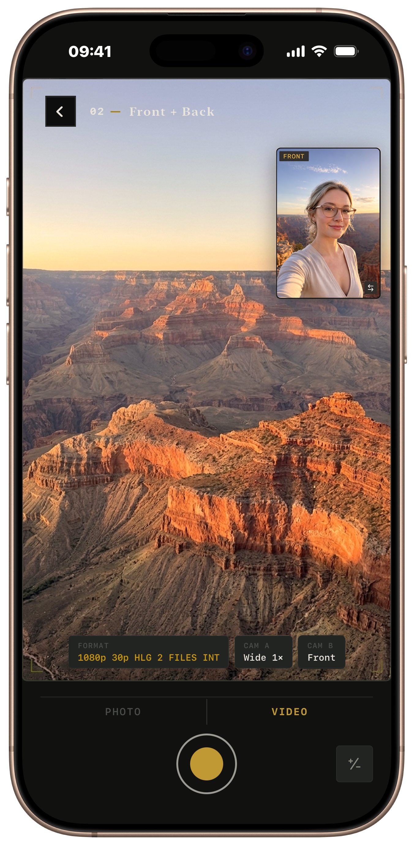
05 · Front + Back Capture
Dual cameras. Full control.
Record the scene and the person behind it in one session. Layout, pairing, format, and save behavior all stay visible enough to trust before you hit record.
Built for setup confidence
- The picture-in-picture view proves the feature before any explanation starts.
- Format and camera pairing sit close to the live image, where decisions happen.
- The page keeps the same dark instrument tone even with brighter footage.
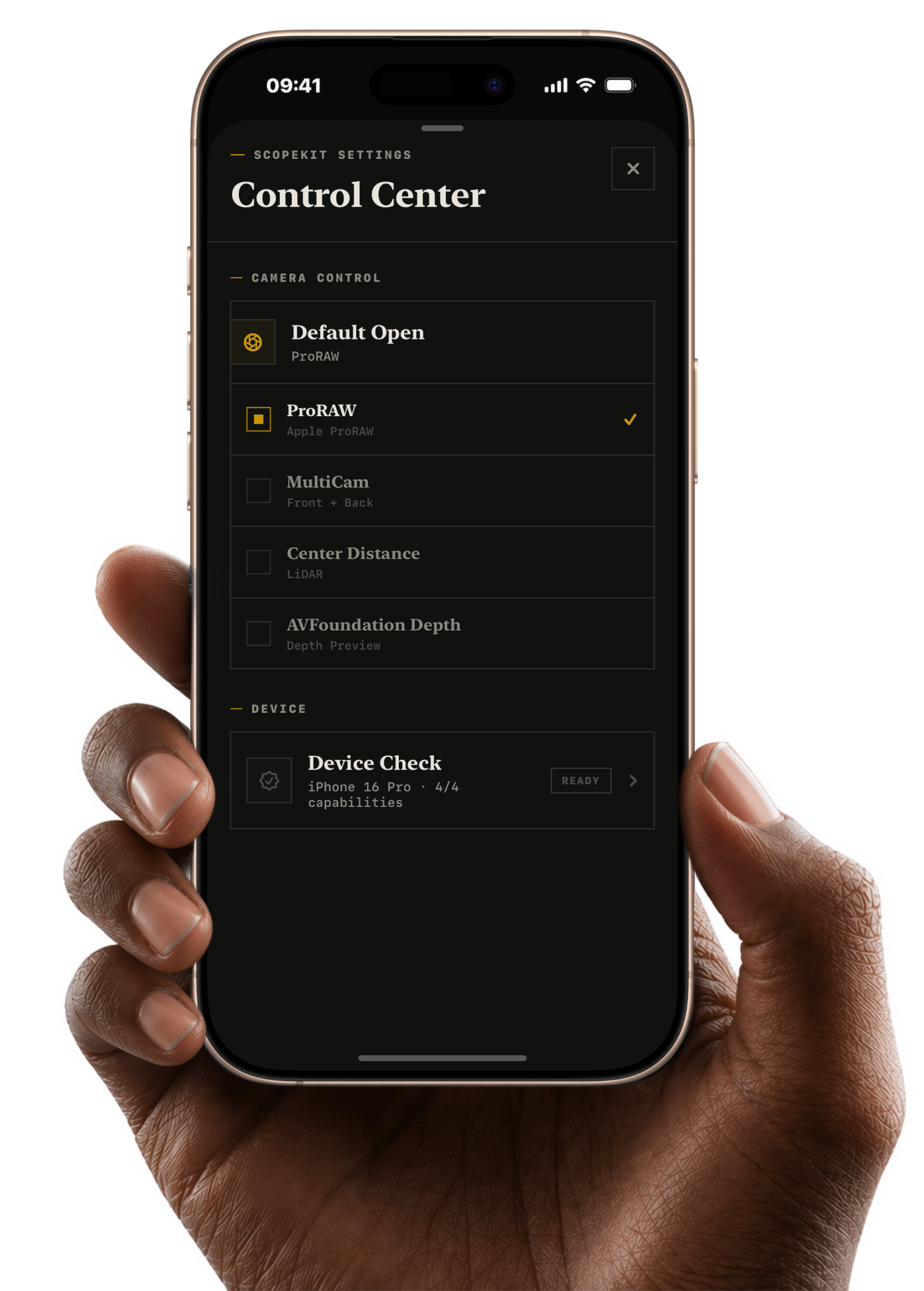
06 · Camera Control
Ready before the shot.
Set the mode you want ScopeKit to open first, then jump straight into capture from Camera Control. The app keeps the launch choice simple so field work starts without digging through menus.
Less setup friction
- Default Open makes the preferred working mode visible and easy to confirm.
- ProRAW, MultiCam, LiDAR, and depth modes stay grouped in one control center.
- The screen explains readiness without turning settings into a second product.